Geotechnical Investigation data evaluation: JS Geo offers a thorough analysis and evaluation of the soil, rock and groundwater characteristics to ensure the safety of the foundations of any project, based on the available accurate and reliable data.
Consulting Services: JS Geo team of experts provide consultations on geotechnical engineering design, helping clients tonavigate complex ground-relatedchallenges.
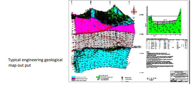
Site Evaluations: JS Geo performs detail site assessments including engineering geological and environmental studies to guide the project planning and risk management.
Foundation Engineering: Specialized team works for designing foundations that optimizes the project techno- economically; besides, safety and durability tailored to meetthe sitespecific conditions.
JS GEO Expertise
Overview of JS Geo Services
Foundation design and analysis
Slope stability assessments
Ground improvement techniques
Providing suitable shoring design with value added services
Liquefaction Analysis Earthworks and site preparation
Environmental impact assessments
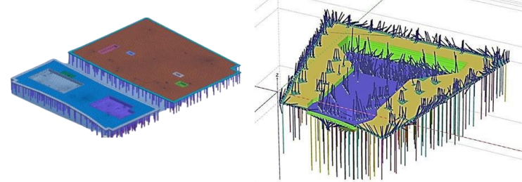
Carrying out Soil Structure Interaction(SSI) Study for towers, bridges,
roads to optimize the designs etc.
Pile design including pile group analysis Shoring design and analysis
Dewatering design and analysis
Preliminary Test Pile(PTP) data evaluation and Interpretation using Euro code and optimizing the pile capacities and Pile designs
Vibration Impact Analysis Evaluation of Ground improvement works etc.
Load-bearing capacity estimation & assessment Combining advanced geotechnical solutions with a client centric approach
JS GEO delivers comprehensive, reliable and innovative geotechnical solutions to support the success of projects.
Special Geotechnical Services
JS GEO, provides several special design services for special applications in the area of Geotechnical and Foundation Engineering. Such services require special qualifications and experiences, supported with detailed knowledge of related codes, guidelines and procedures.
These services are provided to Consultants, contractors or directly to the owners. They can be tailored to meet the project specific requirements. The services include partial or full supervision during actual field executions with monitoring as may be necessary. The special services include.
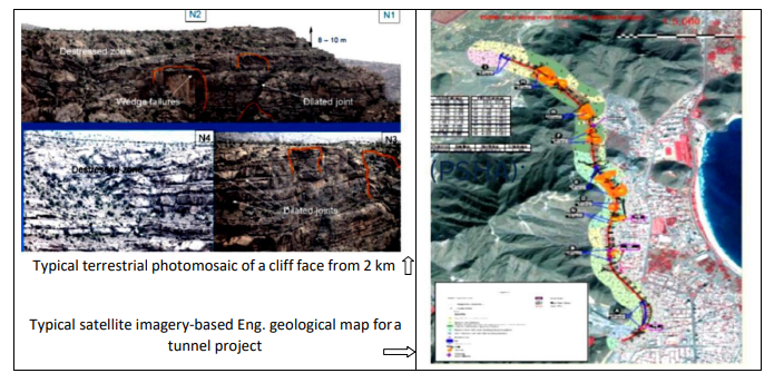
Engineering geological mapping by walkover survey, High resolution satellite imagery studies with mapping and Eng. Geological data collection with discontinuity parameters.
Mod flow Analysis for dewatering project Design of deep ground improvement schemes
Petrography study
Hydrological study
Hydrogeological study
Rock mass characterization and classification (GSI, RMR, Q, SMR) for cut slope sand tunnels/underground excavations
Rock movement monitoring services.
Probabilistic Seismic Hazard Assessment (PSHA)
Engineering Geological Services
Terrestrial photography for Mapping of cliff Slope and condition assessment of Cliff faces and Cut Slope assessments
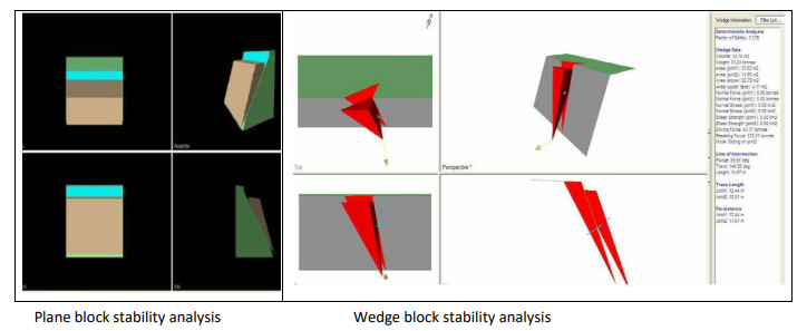
Stereographic projections and kinematic admissibility checks (using Rocscience software)